
This American waterway hides an ancient secret. There are over 28 major impact craters in the United States, but the largest of them all is under the nation’s largest estuary: the Chesapeake Bay.
35.5 million years ago, a massive object hurtled down from space and crashed into what is now southeast Virginia. The impact created a massive, 40 km wide crater and caused megatsunamis that may have reached the Appalachian Mountains. At that time, sea levels were higher, so eastern Virginia was underwater, and the Appalachian Mountains were close to the coast.
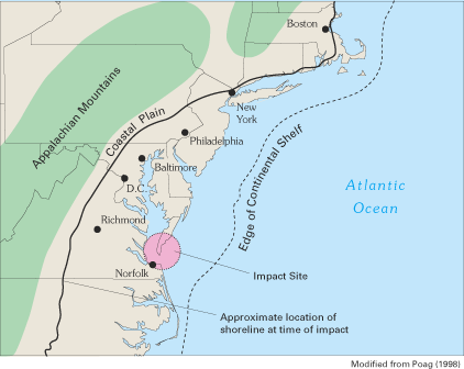
For millions of years this crater remained unknown and hidden from sight. Then, in 1983, geologists found material that had been ejected from the impact all the way up in Atlantic City, New Jersey. Ten years later, oil exploration data revealed the crater’s true extent.
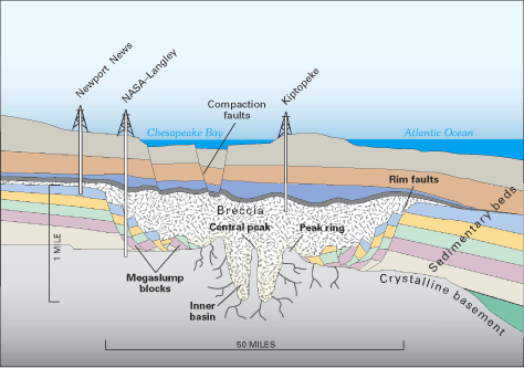
Since the impact event, the crater has doubled in size to over 80 km wide, and it has shaped the Chesapeake Bay and the geography of Hampton Roads aka Tidewater. Rubble from the crater has caused the seabed to slump, shifting the course of the surrounding rivers and sinking the surrounding land.
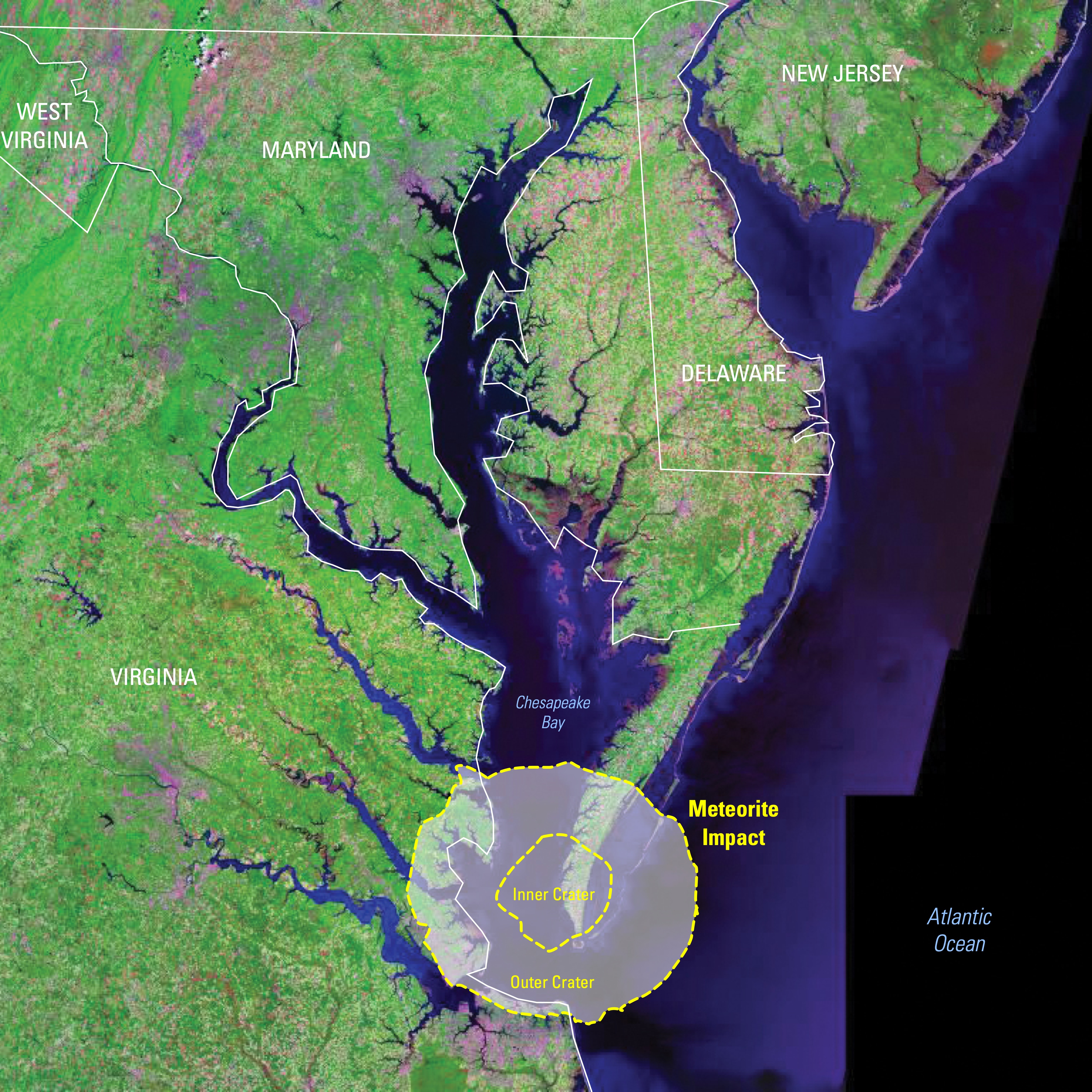
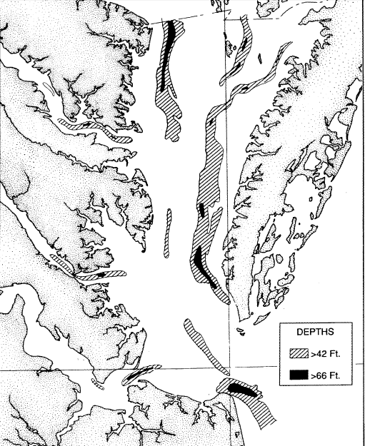
At ground zero, inside the crater’s inner rim, there’s an unusually deep area that I have explored firsthand. This place is located in the eastern Chesapeake Bay, just outside Cape Charles marina on Virginia’s Eastern Shore.
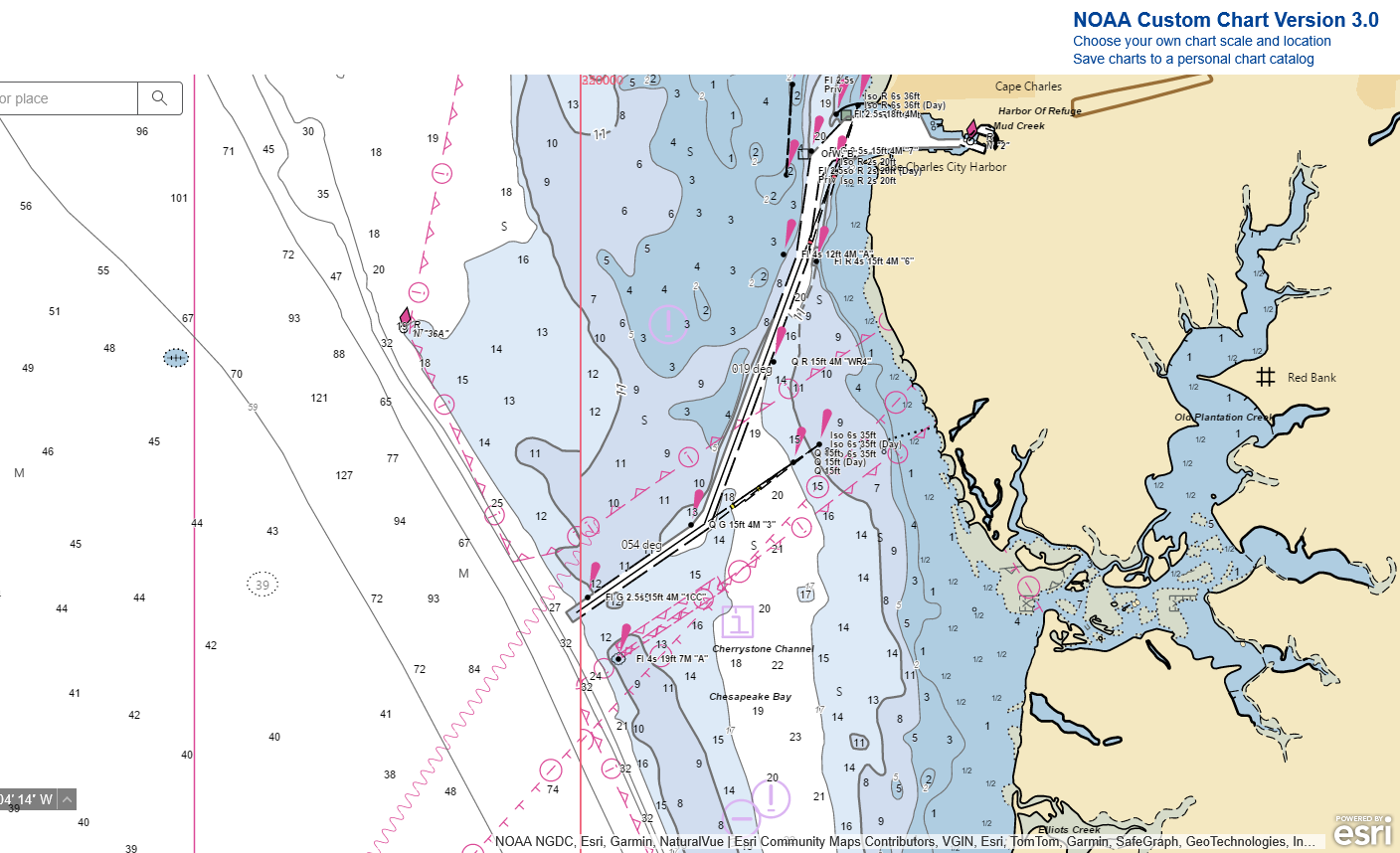
As you can see on my depth finder, the water is over 100 feet. This is pretty significant because the average depth of the Bay is only about 21 feet. I’m no geologist, so I cannot confirm that this deep area was caused by the crater, rather than currents or other natural forces, but I can’t help but think there is some correlation here.
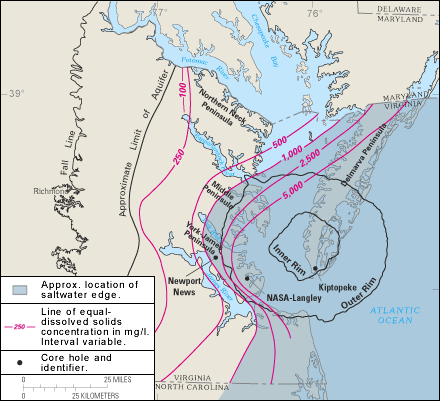
Besides forming the Chesapeake Bay, the crater has affected the region’s groundwater. The aquifers in Southeast Virginia sit above an ancient Cretaceous sea that was buried long ago and turned into a salty brine. The crater has tipped the balance between these two bodies of water, making the region’s drinkable water susceptible to groundwater contamination.
Throughout southeast Virginia, the crater’s impacts are clear. Today, much of the land within the crater’s rim is at war with water, and climate change has supercharged these effects.
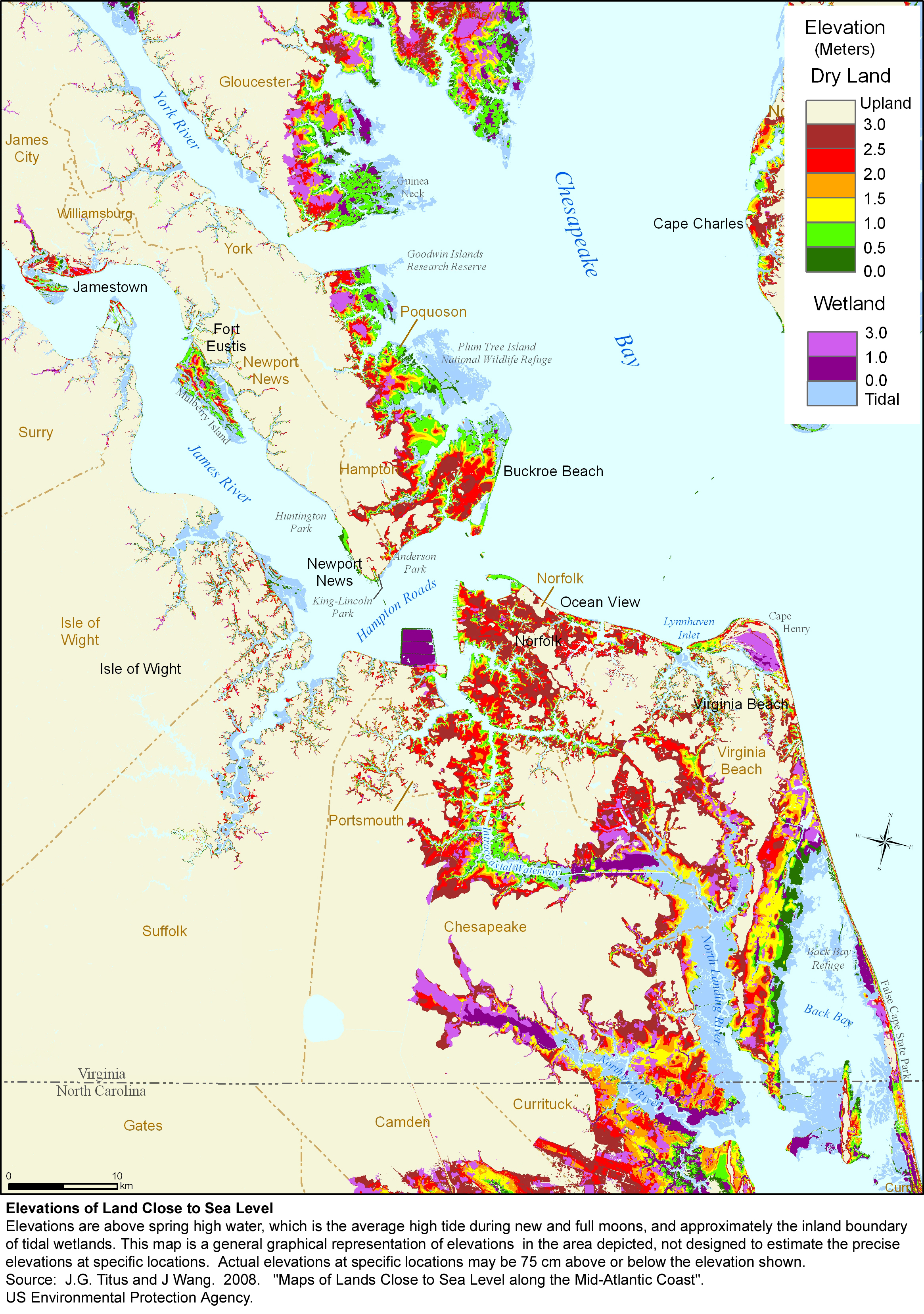
Some cities in Hampton Roads, such as Norfolk, Virginia, already struggle greatly with flooding. Since the 1920s, sea levels at Naval Station Norfolk have risen 18 inches and are projected to rise another 1-3 feet by 2050. Adding sinking land to the mix only worsens the situation. Hopefully, we can keep these floodwaters at bay and continue to reduce the impact of climate change.


